The code below may be distributed publicly, provided that it is cited appropriately. I have begun depositing code (mainly in R) to my GitHub repository (https://github.com/MarisaBSzubryt), but more extensive documentation can be found here as well.
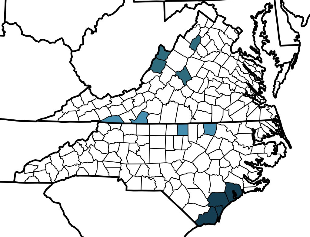
Generating county level maps from coordinates or state-county data:
The code below can be used to generate county-level maps for the contiguous United States, either for one taxon (one color) or multiple taxa (multiple colors). Input data can either take the form of coordinates (“decimalLatitude” and “decimalLongitude”), state and county data (“stateProvince” and “county”), or a list of formatted state-county strings.
https://github.com/MarisaBSzubryt/MBS_County_Maps
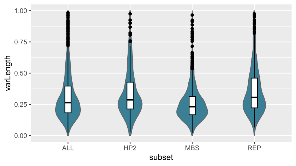
Extracting and plotting gene tree statistics (bootstrap support values, bipartition values, and internal tree length (root-to-tip variance) values can be accomplished through a combination of Unix (with the help of phyx and SortaDate on a Mac computer) and R. To gather more insight about gene tree statistics for target-capture or HybSeq data, see the GitHub repository below.
https://github.com/MarisaBSzubryt/MBS_Extracting_Gene_Tree_Statistics
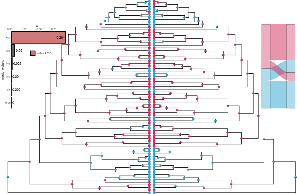
Several phylogenetic comparative methods (PCM) have been collated into one R script at the GitHub link below to run several functions. These include extracting node numbers, divergence times from BEAST chronograms, ancestral state reconstructions (for both discrete and continuous traits, including for stochastic character mapping with discrete states), producing alluvial plots showing trait overlap, canonical correlation analyses (CCA) to assess co-evolution of traits, phylogenetic generalized least squares (PGLS) tests for phylogenetic signal, and causality between traits. For details, see:
github.com/MarisaBSzubryt/MBS_PhylogeneticComparativeMethods
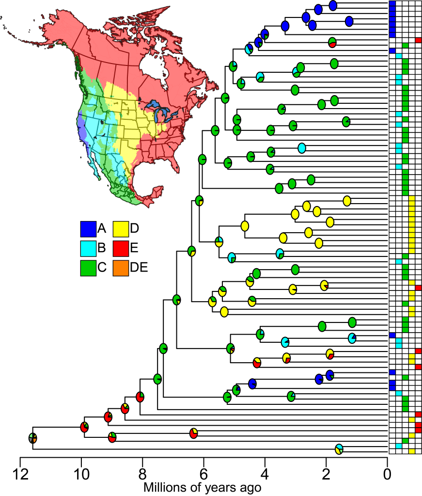
A tutorial for BioGeoBEARS with anonymized example data is available below. This code was largely derived from Nicholas Matzke (http://phylo.wikidot.com/biogeobears#toc29) and requires downloading BioGeoBEARS from GitHub (https://github.com/nmatzke/BioGeoBEARS). Thanks to Jen Mandel (jmandel@memphis.edu), Polla Rodrigues (polla.rodrigues16@gmail.com), and many more for help troubleshooting. See https://github.com/MarisaBSzubryt/MBS_BioGeoBEARS for more.